 NGDC for Kenya
Governement of the United Kingdom (Ordnance Survey) for the Government of the United Republic of Tanzania
Type of resources
Topics
Keywords
Contact for the resource
Provided by
Formats
Update frequencies
status
Scale
-
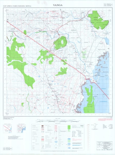
Y742 is a series of 1: 50 000 scale topographic maps which were published between 1963 and 1991. The map series covers the border between Kenya and Tanzania with a number of the maps being published by each government. Several of the maps have been released as a series of versions. The collection held by the Geodata Centre does not include all versions of the maps produced. Publishers: D.O.S. Directorate of \overseas Surveys Tanganyika Government; TSD/OSD Governement of the United Kingdom (Ordnance Survey) for the Government of the United Republic of Tanzania; TSD Ministry of Lands Housing and Urban Development Tanzania; SK Survey Kenya
-
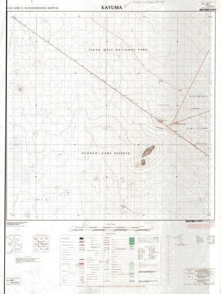
Y742 is a series of 1: 50 000 scale topographic maps which were published between 1963 and 1991. The map series covers the border between Kenya and Tanzania with a number of the maps being published by each government. Several of the maps have been released as a series of versions. The collection held by the Geodata Centre does not include all versions of the maps produced. Publishers: D.O.S. Directorate of \overseas Surveys Tanganyika Government; TSD/OSD Governement of the United Kingdom (Ordnance Survey) for the Government of the United Republic of Tanzania; TSD Ministry of Lands Housing and Urban Development Tanzania; SK Survey Kenya